The Old King's Head, Gurnett
Introduction
The photograph on this page of The Old King's Head, Gurnett by Stephen McKay as part of the Geograph project.
The Geograph project started in 2005 with the aim of publishing, organising and preserving representative images for every square kilometre of Great Britain, Ireland and the Isle of Man.

There are currently over 7.5m images from over 14,400 individuals and you can help contribute to the project by visiting https://www.geograph.org.uk
The Old King's Head, Gurnett
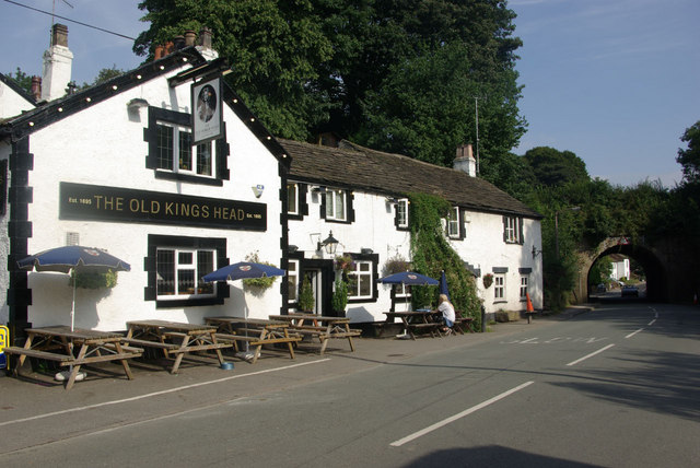
Image: © Stephen McKay Taken: 1 Sep 2010
This old coaching inn is separated from Gurnett village by the aqueduct carrying the Macclesfield Canal (seen on the right of the picture).
Images are licensed for reuse under creativecommons.org/licenses/by-sa/2.0
Image Location
Latitude
53.243618
Longitude
-2.114145