London, King's Cross
Introduction
The photograph on this page of London, King's Cross by Phillip Perry as part of the Geograph project.
The Geograph project started in 2005 with the aim of publishing, organising and preserving representative images for every square kilometre of Great Britain, Ireland and the Isle of Man.

There are currently over 7.5m images from over 14,400 individuals and you can help contribute to the project by visiting https://www.geograph.org.uk
London, King's Cross
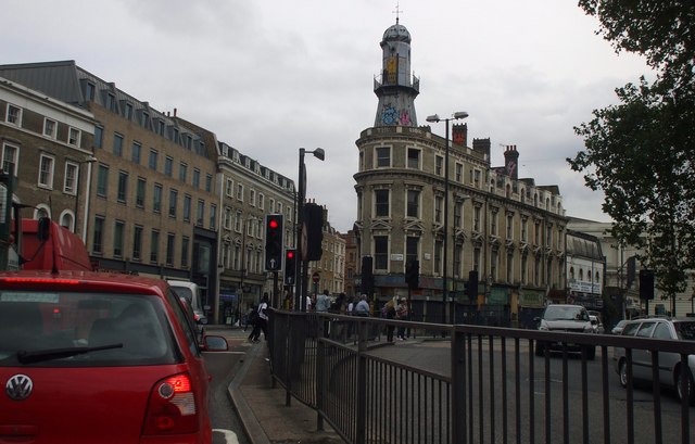
Image: © Phillip Perry Taken: 4 Sep 2010
Right outside King's Cross station, on the left out of shot. Two London boroughs meet, Camden & Islington and 3 postal districts, N1, NW1 & WC1 all in this picture. A very busy road junction Euston Road meets Birkenhead Street (on extreme right), Gray's Inn Road (right), Pentonville Road (ahead) and York Way out of shot on the left. According to the square boundaries, the roads to the right of the barrier are in the next square to the south.
Images are licensed for reuse under creativecommons.org/licenses/by-sa/2.0
Image Location


Leaflet Map data © OpenStreetMap
Latitude
51.530962
Longitude
-0.122346