Howe o' Buchan House, Peterhead
Introduction
The photograph on this page of Howe o' Buchan House, Peterhead by Iain Smith as part of the Geograph project.
The Geograph project started in 2005 with the aim of publishing, organising and preserving representative images for every square kilometre of Great Britain, Ireland and the Isle of Man.

There are currently over 7.5m images from over 14,400 individuals and you can help contribute to the project by visiting https://www.geograph.org.uk
Howe o' Buchan House, Peterhead
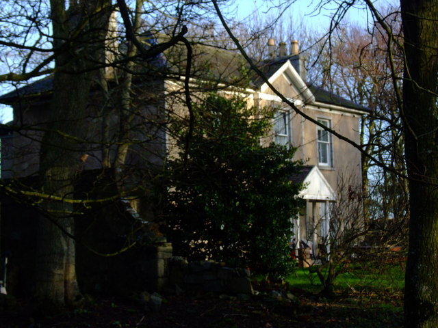
Image: © Iain Smith Taken: 9 Dec 2009
This imposing Category C(s) Listed Building stands beside the roundabout at the Howe o' Buchan on the outskirts of Peterhead. From an inscription above a door Image, it would appear that this house may date from at least 1711, although RCAHMS's CANMORE website http://canmore.rcahms.gov.uk/en/site/21251/details/howe+o+buchan/ has it dating from the 1800's. Research would tend to indicate that the land at Howe O' Buchan was purchased by one Thomas Walker, whose family were originally occupied Waulkmill, a small wool mill and croft on the Aberdour shore that had been owned by the family since about 1720. So unless the house was already there when the land was purchased, the date of 1711 would appear incorrect as a date of building.
Images are licensed for reuse under creativecommons.org/licenses/by-sa/2.0
Image Location
Latitude
57.508032
Longitude
-1.824416