Telephone Exchange, Quainton, Bucks
Introduction
The photograph on this page of Telephone Exchange, Quainton, Bucks by David Hillas as part of the Geograph project.
The Geograph project started in 2005 with the aim of publishing, organising and preserving representative images for every square kilometre of Great Britain, Ireland and the Isle of Man.

There are currently over 7.5m images from over 14,400 individuals and you can help contribute to the project by visiting https://www.geograph.org.uk
Telephone Exchange, Quainton, Bucks
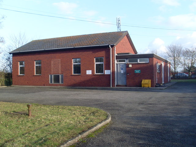
Image: © David Hillas Taken: 5 Feb 2010
Situated in Station Road near Quainton Road Station, this modern redbrick TE, which has the code SMWAD, replaced the former TEs in Frederick Street, Waddesdon in the early 1980s, SP 7416 refers http://www.geograph.org.uk/photo/2048964, and Lower Street, Quainton in the early 1990s, now demolished. It provides telephone and broadband services to 1,636 residential and 147 non-residential premises in Quainton and Waddesdon, plus Ashendon, Upper Winchendon and Westcott nearby. The postcode of this TE is HP22 4BY.
Images are licensed for reuse under creativecommons.org/licenses/by-sa/2.0
Image Location
Latitude
51.865058
Longitude
-0.92847