Terrace, Carrickfergus
Introduction
The photograph on this page of Terrace, Carrickfergus by Albert Bridge as part of the Geograph project.
The Geograph project started in 2005 with the aim of publishing, organising and preserving representative images for every square kilometre of Great Britain, Ireland and the Isle of Man.

There are currently over 7.5m images from over 14,400 individuals and you can help contribute to the project by visiting https://www.geograph.org.uk
Terrace, Carrickfergus
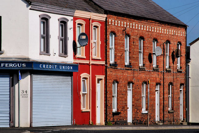
Image: © Albert Bridge Taken: 2 Sep 2010
A terrace on the Albert Road, between Unity Street and Thomas Street, displaying two different styles. The house nearest the camera has been altered. The redbrick ones remain unchanged.
Images are licensed for reuse under creativecommons.org/licenses/by-sa/2.0
Image Location
Latitude
54.716229
Longitude
-5.809478