St Dochdwy's Church, Llandough
Introduction
The photograph on this page of St Dochdwy's Church, Llandough by Jaggery as part of the Geograph project.
The Geograph project started in 2005 with the aim of publishing, organising and preserving representative images for every square kilometre of Great Britain, Ireland and the Isle of Man.

There are currently over 7.5m images from over 14,400 individuals and you can help contribute to the project by visiting https://www.geograph.org.uk
St Dochdwy's Church, Llandough
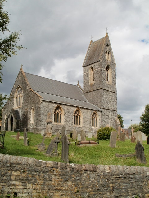
Image: © Jaggery Taken: 5 Aug 2010
Viewed from Llandough Hill (a road connecting Llandough with Penarth Road). Parts of the structure date from the 12th century, but there have been several rebuilds of the church, including a major one in the mid 19th century. The village of Llandough derives its name from the saint. The Welsh name of the village is Llandochau Fach. Llan = the area near a church. Dochau is a variant of Dochdwy.
Images are licensed for reuse under creativecommons.org/licenses/by-sa/2.0
Image Location
Latitude
51.451647
Longitude
-3.198735