Ffynnon Beuno, Bala
Introduction
The photograph on this page of Ffynnon Beuno, Bala by Eirian Evans as part of the Geograph project.
The Geograph project started in 2005 with the aim of publishing, organising and preserving representative images for every square kilometre of Great Britain, Ireland and the Isle of Man.

There are currently over 7.5m images from over 14,400 individuals and you can help contribute to the project by visiting https://www.geograph.org.uk
Ffynnon Beuno, Bala
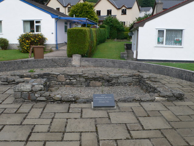
Image: © Eirian Evans Taken: 23 Jul 2010
The site of St Beuno's Well, at Mawnog Bach, Bala. The well which at one time provided pure water was later filled in with builders rubble when the estate was built. However, it was later cleared of rubble and filled with chippings which would be easy to remove later if needed.
Images are licensed for reuse under creativecommons.org/licenses/by-sa/2.0
Image Location
Latitude
52.909042
Longitude
-3.604992