The Red Row, Banbridge
Introduction
The photograph on this page of The Red Row, Banbridge by Albert Bridge as part of the Geograph project.
The Geograph project started in 2005 with the aim of publishing, organising and preserving representative images for every square kilometre of Great Britain, Ireland and the Isle of Man.

There are currently over 7.5m images from over 14,400 individuals and you can help contribute to the project by visiting https://www.geograph.org.uk
The Red Row, Banbridge
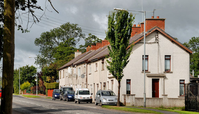
Image: © Albert Bridge Taken: 28 Aug 2010
Not red anymore and officially called Hockley Terrace – a terrace on the northern side of the Scarva Road – once redbrick but now rendered. There used to be a hand pump at the far end. Note for genealogists: there are/were several “Red Rows” in the area around Banbridge, Seapatrick and Lenaderg.
Images are licensed for reuse under creativecommons.org/licenses/by-sa/2.0
Image Location
Latitude
54.350415
Longitude
-6.285661