Ainsley Road
Introduction
The photograph on this page of Ainsley Road by John Sutton as part of the Geograph project.
The Geograph project started in 2005 with the aim of publishing, organising and preserving representative images for every square kilometre of Great Britain, Ireland and the Isle of Man.

There are currently over 7.5m images from over 14,400 individuals and you can help contribute to the project by visiting https://www.geograph.org.uk
Ainsley Road
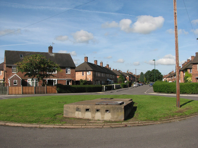
Image: © John Sutton Taken: 27 Aug 2010
This small council estate to the east of Western Boulevard was laid out in the late 1930s. I wondered if this concrete structure was an air-raid shelter entrance, but my friend Tim Dale, who lived nearby in the fifties and sixties, thinks it is something to do with the drainage system.
Images are licensed for reuse under creativecommons.org/licenses/by-sa/2.0
Image Location
Latitude
52.96034
Longitude
-1.185944