Corner of Vinegar Hill and Main Road, Undy
Introduction
The photograph on this page of Corner of Vinegar Hill and Main Road, Undy by Jaggery as part of the Geograph project.
The Geograph project started in 2005 with the aim of publishing, organising and preserving representative images for every square kilometre of Great Britain, Ireland and the Isle of Man.

There are currently over 7.5m images from over 14,400 individuals and you can help contribute to the project by visiting https://www.geograph.org.uk
Corner of Vinegar Hill and Main Road, Undy
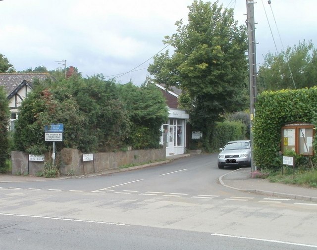
Image: © Jaggery Taken: 14 Aug 2010
Vinegar Hill heads away from Main Road, the local name for the B4245. A blue sign at the start of Vinegar Hill states that the route is not suitable for heavy goods vehicles. The white sign below it states 'No access to residential developments'. The small white shop beside a tree is Nails by Design.
Images are licensed for reuse under creativecommons.org/licenses/by-sa/2.0
Image Location
Latitude
51.579006
Longitude
-2.818203