Dereliction at Boys Village
Introduction
The photograph on this page of Dereliction at Boys Village by Gareth James as part of the Geograph project.
The Geograph project started in 2005 with the aim of publishing, organising and preserving representative images for every square kilometre of Great Britain, Ireland and the Isle of Man.

There are currently over 7.5m images from over 14,400 individuals and you can help contribute to the project by visiting https://www.geograph.org.uk
Dereliction at Boys Village
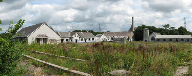
Image: © Gareth James Taken: 11 Aug 2010
Remains of the former summer camp for boys - it was opened in 1930 and closed in the 1980s/90s (depending on which source you believe!) From left to right: sleeping block E & F, dining block, sanitory block, games hall, chapel and sleeping hut C & D.
Images are licensed for reuse under creativecommons.org/licenses/by-sa/2.0
Image Location
Latitude
51.394558
Longitude
-3.400488