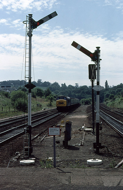
Approaching Elstree & Boreham Wood
Introduction
The photograph on this page of Approaching Elstree & Boreham Wood by Martin Addison as part of the Geograph project.
The Geograph project started in 2005 with the aim of publishing, organising and preserving representative images for every square kilometre of Great Britain, Ireland and the Isle of Man.
There are currently over 7.5m images from over 14,400 individuals and you can help contribute to the project by visiting https://www.geograph.org.uk

Image: © Martin Addison Taken: Unknown
Bracketed by semaphore signals, a class 45 diesel locomotive approaches the station at speed with a fast passenger service from St. Pancras. It has just exited the tunnels that carry the line under Deacons Hill and Scratchwood. The semaphore signals are in their last months of service (in 1979) as they are to be replaced with colour light signalling - one of which is visible with the white X denoting that it is not in use. John Webb informs me that the buildings at the top of the embankment on the left belonged to the Fire Research Station. The site now has houses on it.

