Cyfleusterau cyhoeddus wedi eu haddasu / Converted public conveniences
Introduction
The photograph on this page of Cyfleusterau cyhoeddus wedi eu haddasu / Converted public conveniences by Ceri Thomas as part of the Geograph project.
The Geograph project started in 2005 with the aim of publishing, organising and preserving representative images for every square kilometre of Great Britain, Ireland and the Isle of Man.

There are currently over 7.5m images from over 14,400 individuals and you can help contribute to the project by visiting https://www.geograph.org.uk
Cyfleusterau cyhoeddus wedi eu haddasu / Converted public conveniences
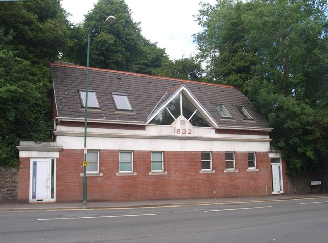
Image: © Ceri Thomas Taken: 5 Aug 2010
This building is now an architect's studio, but the separate entrances at each end and the inscription EVUDC suggest a different former use.
Images are licensed for reuse under creativecommons.org/licenses/by-sa/2.0
Image Location
Latitude
51.773632
Longitude
-3.208409