Talbot Road
Introduction
The photograph on this page of Talbot Road by Martin Addison as part of the Geograph project.
The Geograph project started in 2005 with the aim of publishing, organising and preserving representative images for every square kilometre of Great Britain, Ireland and the Isle of Man.

There are currently over 7.5m images from over 14,400 individuals and you can help contribute to the project by visiting https://www.geograph.org.uk
Talbot Road
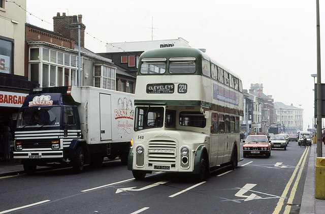
Image: © Martin Addison Taken: Unknown
A busy scene on Talbot Road with a stream of traffic climbing up into the town. The bus is turning right into Topping Street. The left turn lane is for traffic joining Dickson Road. Talbot Road is currently a one way street in the opposite direction to the oncoming traffic in the photo.
Images are licensed for reuse under creativecommons.org/licenses/by-sa/2.0
Image Location
Latitude
53.819792
Longitude
-3.05232