Headingley Cricket Ground: the Carnegie Pavilion
Introduction
The photograph on this page of Headingley Cricket Ground: the Carnegie Pavilion by John Sutton as part of the Geograph project.
The Geograph project started in 2005 with the aim of publishing, organising and preserving representative images for every square kilometre of Great Britain, Ireland and the Isle of Man.

There are currently over 7.5m images from over 14,400 individuals and you can help contribute to the project by visiting https://www.geograph.org.uk
Headingley Cricket Ground: the Carnegie Pavilion
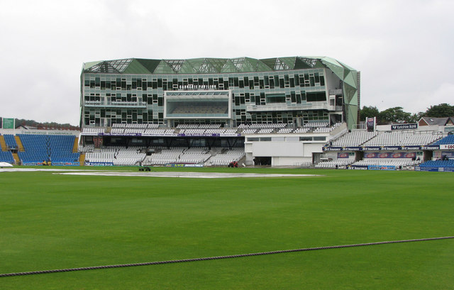
Image: © John Sutton Taken: 4 Aug 2010
The new pavilion at the Kirkstall Lane End is a bold affair. It will probably take some while to grow on those who prefer more traditional designs. There was no play before lunch on Day 2 of the Yorkshire-Notts game, but plenty afterwards, all of it to the taste of visiting supporters.
Images are licensed for reuse under creativecommons.org/licenses/by-sa/2.0
Image Location
Latitude
53.818293
Longitude
-1.582717