Downland village
Introduction
The photograph on this page of Downland village by Shazz as part of the Geograph project.
The Geograph project started in 2005 with the aim of publishing, organising and preserving representative images for every square kilometre of Great Britain, Ireland and the Isle of Man.

There are currently over 7.5m images from over 14,400 individuals and you can help contribute to the project by visiting https://www.geograph.org.uk
Downland village
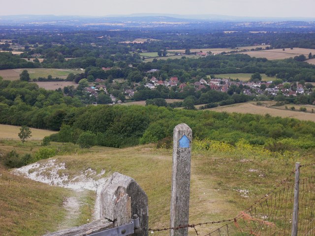
Image: © Shazz Taken: 30 Jul 2010
This is a view of Washington in West Sussex. The bridleway is entering a disused chalk pit. Central to the skyline is Blackdown, which is the highest point in all Sussex. The headland on the horizon to the left of the picture is Bexleyhill but the picture quality is not sufficient to show the mast.
Images are licensed for reuse under creativecommons.org/licenses/by-sa/2.0
Image Location
Latitude
50.904344
Longitude
-0.407378