Queen Street Mills
Introduction
The photograph on this page of Queen Street Mills by Gerald England as part of the Geograph project.
The Geograph project started in 2005 with the aim of publishing, organising and preserving representative images for every square kilometre of Great Britain, Ireland and the Isle of Man.

There are currently over 7.5m images from over 14,400 individuals and you can help contribute to the project by visiting https://www.geograph.org.uk
Queen Street Mills
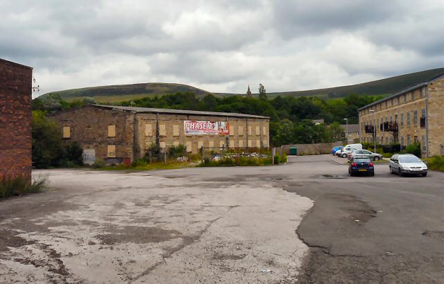
Image: © Gerald England Taken: 27 Jul 2010
Two old mills by the River Tame. One has already been converted into flats. Despite a large sign proclaiming Phase Two to be completed in 2009, the second mill appears to be still boarded up awaiting conversion.
Images are licensed for reuse under creativecommons.org/licenses/by-sa/2.0
Image Location
Latitude
53.515391
Longitude
-2.038869