
Seaview Terrace
Introduction
The photograph on this page of Seaview Terrace by Tony Atkin as part of the Geograph project.
The Geograph project started in 2005 with the aim of publishing, organising and preserving representative images for every square kilometre of Great Britain, Ireland and the Isle of Man.

There are currently over 7.5m images from over 14,400 individuals and you can help contribute to the project by visiting https://www.geograph.org.uk
Seaview Terrace
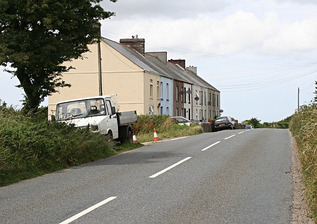
Image: © Tony Atkin Taken: 8 Jul 2006
An isolated terrace of houses built high up on the western slope of the St Austell granite and just below the even higher spoil heaps. Presumably these were originally built for workers at the china clay works. Even though these houses are about as far inland as you can get in mid Cornwall, I imagine that on a clear day you can get a good view of the sea from up here. Probably both north and south coasts.
Images are licensed for reuse under creativecommons.org/licenses/by-sa/2.0
Image Location

Latitude
50.360586
Longitude
-4.932772