Water Tower in Tower Road
Introduction
The photograph on this page of Water Tower in Tower Road by Rob Candlish as part of the Geograph project.
The Geograph project started in 2005 with the aim of publishing, organising and preserving representative images for every square kilometre of Great Britain, Ireland and the Isle of Man.

There are currently over 7.5m images from over 14,400 individuals and you can help contribute to the project by visiting https://www.geograph.org.uk
Water Tower in Tower Road
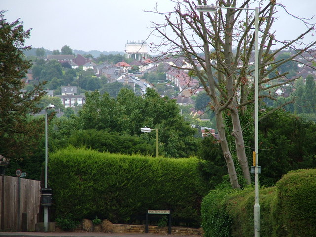
Image: © Rob Candlish Taken: 26 Jul 2010
This photo was actually taken with a long lens in Walton Road, Ware at TL359138 and looks over two other grid squares (TL3614 and TL3615). The principal feature is the water tower on the horizon and in grid square TL3615, which gives Tower Road on the other side of the town its name. The photo also emphasises that the centre of Ware stands at the bottom of the Lea Valley. Modern housing built in the 1950s and 1960s has encroached up the valley sides to both the north and south of the town though.
Images are licensed for reuse under creativecommons.org/licenses/by-sa/2.0
Image Location
Latitude
51.817525
Longitude
-0.022241