St Werburgh's Church tower.
Introduction
The photograph on this page of St Werburgh's Church tower. by Sharon Loxton as part of the Geograph project.
The Geograph project started in 2005 with the aim of publishing, organising and preserving representative images for every square kilometre of Great Britain, Ireland and the Isle of Man.

There are currently over 7.5m images from over 14,400 individuals and you can help contribute to the project by visiting https://www.geograph.org.uk
St Werburgh's Church tower.
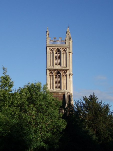
Image: © Sharon Loxton Taken: 7 Jul 2006
St.Werburgh's Church was relocated stone-by-stone to Mina Road in this district from Corn Street, Bristol in 1879. The 15th century church no longer serves any religious purpose; it is now the home of the Bristol Climbing Centre and inside has 12 metre high climbing walls, pillars, fins, overhangs and arches. See also http://www.churchcrawler.pwp.blueyonder.co.uk/swerbnew.htm
Images are licensed for reuse under creativecommons.org/licenses/by-sa/2.0
Image Location


Leaflet Map data © OpenStreetMap
Latitude
51.471641
Longitude
-2.577282