East end of All Hallows Church
Introduction
The photograph on this page of East end of All Hallows Church by Stephen Craven as part of the Geograph project.
The Geograph project started in 2005 with the aim of publishing, organising and preserving representative images for every square kilometre of Great Britain, Ireland and the Isle of Man.

There are currently over 7.5m images from over 14,400 individuals and you can help contribute to the project by visiting https://www.geograph.org.uk
East end of All Hallows Church
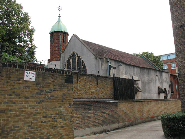
Image: © Stephen Craven Taken: 23 Jul 2010
The west end of this disused church is seen in Image This is the east end, with a distinctive copper-domed octagonal turret, seen clearly only from the flats behind it. Its grounds form a local amenity Image
Images are licensed for reuse under creativecommons.org/licenses/by-sa/2.0
Image Location
Latitude
51.503228
Longitude
-0.097694