Pillgwenlly Library and Information Centre, Newport
Introduction
The photograph on this page of Pillgwenlly Library and Information Centre, Newport by Jaggery as part of the Geograph project.
The Geograph project started in 2005 with the aim of publishing, organising and preserving representative images for every square kilometre of Great Britain, Ireland and the Isle of Man.

There are currently over 7.5m images from over 14,400 individuals and you can help contribute to the project by visiting https://www.geograph.org.uk
Pillgwenlly Library and Information Centre, Newport
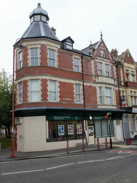
Image: © Jaggery Taken: 5 Oct 2009
Located at 110-111 Commercial Road, Pill, this is one of eleven community libraries run by Newport City Council. The formal name 'Pillgwenlly' is used, whereas 'Pill' is the one used locally. The branch opened in January 2009, replacing the previous Pill branch http://www.geograph.org.uk/photo/2199751 in Temple Street.
Images are licensed for reuse under creativecommons.org/licenses/by-sa/2.0
Image Location
Latitude
51.574998
Longitude
-2.988408