Covert Lane
Introduction
The photograph on this page of Covert Lane by P L Chadwick as part of the Geograph project.
The Geograph project started in 2005 with the aim of publishing, organising and preserving representative images for every square kilometre of Great Britain, Ireland and the Isle of Man.

There are currently over 7.5m images from over 14,400 individuals and you can help contribute to the project by visiting https://www.geograph.org.uk
Covert Lane
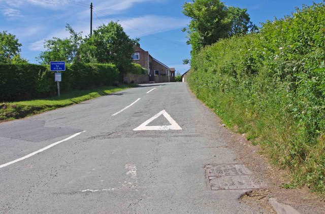
Image: © P L Chadwick Taken: 21 Jun 2010
This is the start of Covert Lane. It runs from its junction here with the B4555, to the hamlet of Billingsley, where it terminates at a junction with the B4363 road. The lane gives access to a few farms, in this very rural part of Shropshire. The notice on the left states the lane is unsuitable for heavy goods vehicles.
Images are licensed for reuse under creativecommons.org/licenses/by-sa/2.0
Image Location


Leaflet Map data © OpenStreetMap
Latitude
52.475926
Longitude
-2.401888