Fox Hill: Penge boundary sign
Introduction
The photograph on this page of Fox Hill: Penge boundary sign by Christopher Hilton as part of the Geograph project.
The Geograph project started in 2005 with the aim of publishing, organising and preserving representative images for every square kilometre of Great Britain, Ireland and the Isle of Man.

There are currently over 7.5m images from over 14,400 individuals and you can help contribute to the project by visiting https://www.geograph.org.uk
Fox Hill: Penge boundary sign
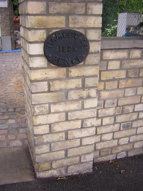
Image: © Christopher Hilton Taken: 14 Jul 2009
Unusually, the border between administrative areas here runs not down the middle of the road but along the garden frontage. The road and houses on its southern side lies in the borough of Croydon; the houses and gardens to the north lie in the borough of Bromley. Prior to 1965 this was the border between Croydon in Surrey and the borough of Penge in Kent. Penge in its turn was, originally, a detached portion ("hamlet") of the parish of Battersea, an arrangement going back to medieval land ownership patterns.
Images are licensed for reuse under creativecommons.org/licenses/by-sa/2.0
Image Location
Latitude
51.415414
Longitude
-0.078332