Kynnersley Arms (1)
Introduction
The photograph on this page of Kynnersley Arms (1) by P L Chadwick as part of the Geograph project.
The Geograph project started in 2005 with the aim of publishing, organising and preserving representative images for every square kilometre of Great Britain, Ireland and the Isle of Man.

There are currently over 7.5m images from over 14,400 individuals and you can help contribute to the project by visiting https://www.geograph.org.uk
Kynnersley Arms (1)
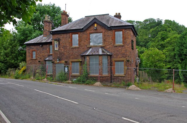
Image: © P L Chadwick Taken: 10 Jul 2010
The pub is on the B4380 road. It closed in the early months of 2008, because a new licensee could not be found to take it on. The circular razor wire around the pub was put up by the Police to stop further attempts to break into the pub, and to deter thieves from stealing lead from the roof. It was reported in a local paper, early in 2009, that attempts were being made to re-open it, but there were legal problems. When this photograph was taken in July 2010, it had already been closed for over two years. Image Image
Images are licensed for reuse under creativecommons.org/licenses/by-sa/2.0
Image Location


Leaflet Map data © OpenStreetMap
Latitude
52.646009
Longitude
-2.57711