The Western Hope Valley Viewed from Treak Cliff
Introduction
The photograph on this page of The Western Hope Valley Viewed from Treak Cliff by Jonathan Clitheroe as part of the Geograph project.
The Geograph project started in 2005 with the aim of publishing, organising and preserving representative images for every square kilometre of Great Britain, Ireland and the Isle of Man.

There are currently over 7.5m images from over 14,400 individuals and you can help contribute to the project by visiting https://www.geograph.org.uk
The Western Hope Valley Viewed from Treak Cliff
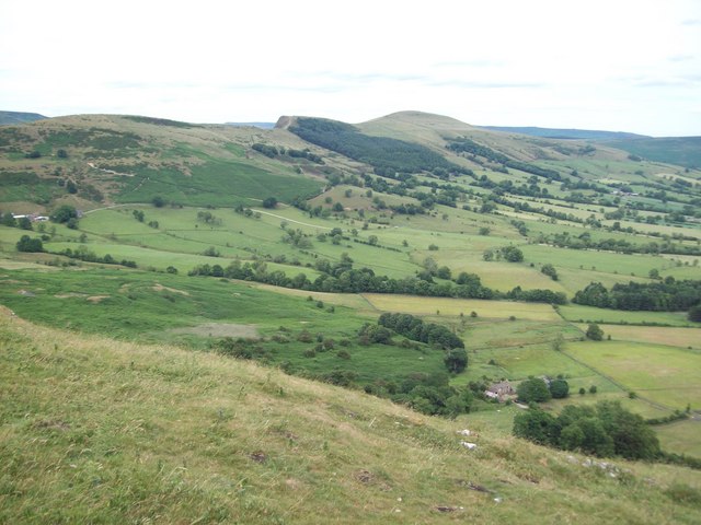
Image: © Jonathan Clitheroe Taken: 11 Jul 2010
Several features can be picked out here. The building to the bottom-right is Knowlegates Farm and the darker area to the left of this is the disused Odin Mine. Hollin's Cross, Back Tor and Lose Hill are all visible on the horizon.
Images are licensed for reuse under creativecommons.org/licenses/by-sa/2.0
Image Location
Latitude
53.347497
Longitude
-1.795521