Buildings between Bolton Brow and the canal wharf, Sowerby Bridge
Introduction
The photograph on this page of Buildings between Bolton Brow and the canal wharf, Sowerby Bridge by Humphrey Bolton as part of the Geograph project.
The Geograph project started in 2005 with the aim of publishing, organising and preserving representative images for every square kilometre of Great Britain, Ireland and the Isle of Man.

There are currently over 7.5m images from over 14,400 individuals and you can help contribute to the project by visiting https://www.geograph.org.uk
Buildings between Bolton Brow and the canal wharf, Sowerby Bridge
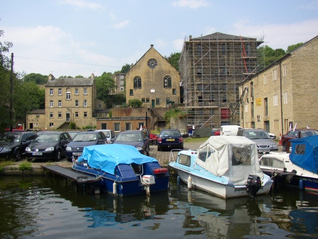
Image: © Humphrey Bolton Taken: 2 Jul 2006
These buildings front onto the main road two storeys above the basement doors at wharf level. On the left is the wharf superintendent's house. Next the Methodist Sunday School, and then the former chapel in process of conversion to (probably) apartments. The basement rooms of this were used for stabling etc for the canal wharf. On the right is the oldest surviving warehouse, No.4 built in 1778.
Images are licensed for reuse under creativecommons.org/licenses/by-sa/2.0
Image Location


Leaflet Map data © OpenStreetMap
Latitude
53.709685
Longitude
-1.904518