Old Swimming Hole on the Elwy
Introduction
The photograph on this page of Old Swimming Hole on the Elwy by Joseph Jones as part of the Geograph project.
The Geograph project started in 2005 with the aim of publishing, organising and preserving representative images for every square kilometre of Great Britain, Ireland and the Isle of Man.

There are currently over 7.5m images from over 14,400 individuals and you can help contribute to the project by visiting https://www.geograph.org.uk
Old Swimming Hole on the Elwy
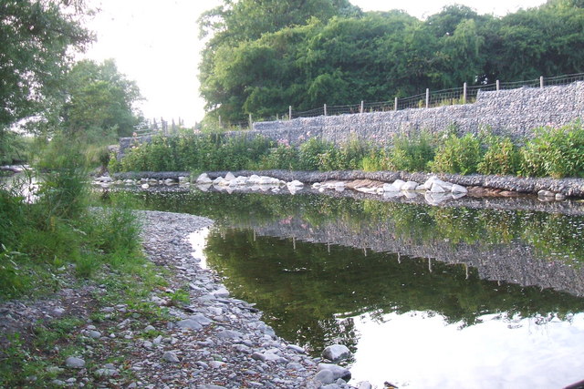
Image: © Joseph Jones Taken: 3 Jul 2010
This stretch of the river was used by local kids as a swimming hole - running and jumping in from the east bank. This activity has now been stopped by the erosion defence walls and barbed wire fence. Rights of way follow both banks of the Elwy - the east one, which we are looking at, ends 100 metres south below Bryn Asaph.
Images are licensed for reuse under creativecommons.org/licenses/by-sa/2.0
Image Location


Leaflet Map data © OpenStreetMap
Latitude
53.248998
Longitude
-3.43978