Under, over, under
Introduction
The photograph on this page of Under, over, under by Bob Embleton as part of the Geograph project.
The Geograph project started in 2005 with the aim of publishing, organising and preserving representative images for every square kilometre of Great Britain, Ireland and the Isle of Man.

There are currently over 7.5m images from over 14,400 individuals and you can help contribute to the project by visiting https://www.geograph.org.uk
Under, over, under
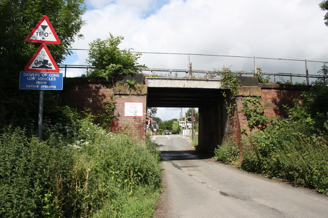
Image: © Bob Embleton Taken: 2 Jul 2010
Springwell Lane crosses three railway lines in a couple of hundred metres. First it goes under the descending line from Northallerton station (to the left) to Teeside. It then goes over the unmanned level crossing taking the low level goods line to Teeside avoiding the station. In the distance beyond the cars is the bridge taking the electrified London to Edinburgh high level line.
Images are licensed for reuse under creativecommons.org/licenses/by-sa/2.0
Image Location
Latitude
54.339012
Longitude
-1.443346