6 Burderop, Swindon (1)
Introduction
The photograph on this page of 6 Burderop, Swindon (1) by Brian Robert Marshall as part of the Geograph project.
The Geograph project started in 2005 with the aim of publishing, organising and preserving representative images for every square kilometre of Great Britain, Ireland and the Isle of Man.

There are currently over 7.5m images from over 14,400 individuals and you can help contribute to the project by visiting https://www.geograph.org.uk
6 Burderop, Swindon (1)
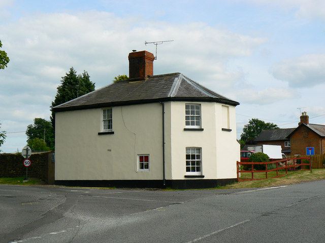
Image: © Brian Robert Marshall Taken: 30 Jun 2010
The former toll house is situated on the corner of the B4005 road between Wroughton, behind the viewpoint, and Chiseldon to the east past the left of the house. The road to the right leads to Barbury Castle. It is marked as a 'no through road' now but between 1761 and 1875 it was a turnpike road to Marlborough and Everleigh and the tolls were taken at the house then named Burderop Gate. Thanks to a fellow contributor for the additional information. Listed Grade II.
Images are licensed for reuse under creativecommons.org/licenses/by-sa/2.0
Image Location
Latitude
51.518147
Longitude
-1.76547