Churchyard of St Mary the Virgin, Mortlake
Introduction
The photograph on this page of Churchyard of St Mary the Virgin, Mortlake by Marathon as part of the Geograph project.
The Geograph project started in 2005 with the aim of publishing, organising and preserving representative images for every square kilometre of Great Britain, Ireland and the Isle of Man.

There are currently over 7.5m images from over 14,400 individuals and you can help contribute to the project by visiting https://www.geograph.org.uk
Churchyard of St Mary the Virgin, Mortlake
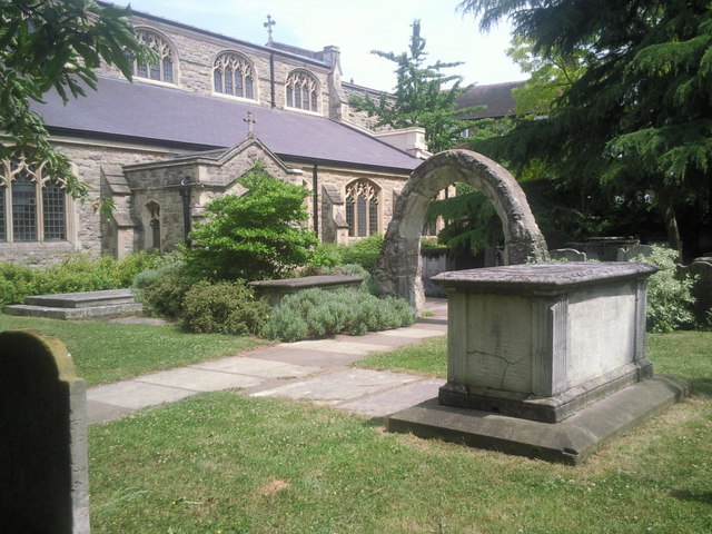
Image: © Marathon Taken: 23 Jun 2010
There are some interesting tombs in the churchyard and an attractive history board with details of the more eminent people buried here. The arch was saved from the old church.
Images are licensed for reuse under creativecommons.org/licenses/by-sa/2.0
Image Location


Leaflet Map data © OpenStreetMap
Latitude
51.469627
Longitude
-0.261936