Burghead Station (remains)
Introduction
The photograph on this page of Burghead Station (remains) by Ben Brooksbank as part of the Geograph project.
The Geograph project started in 2005 with the aim of publishing, organising and preserving representative images for every square kilometre of Great Britain, Ireland and the Isle of Man.

There are currently over 7.5m images from over 14,400 individuals and you can help contribute to the project by visiting https://www.geograph.org.uk
Burghead Station (remains)
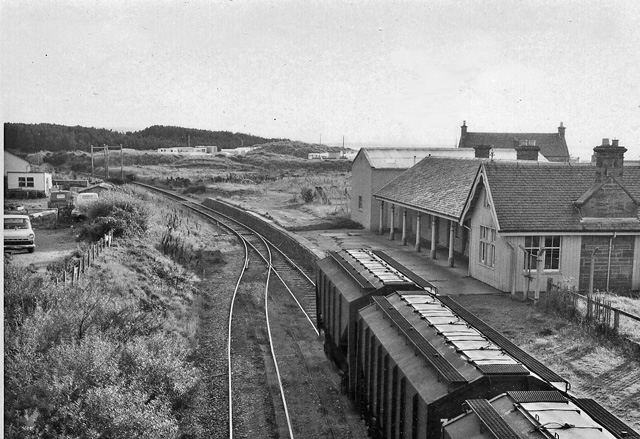
Image: © Ben Brooksbank Taken: 22 Sep 1974
View southward, towards Alves; ex-Highland, Alves - Hopeman branch. This station lost its passengers on 14/9/31 when the branch services ceased. Goods traffic continued until 7/11/66, although cut back from Hopeman on 30/12/57. (The large wagons in the foreground were for the large Burghead Maltings).
Images are licensed for reuse under creativecommons.org/licenses/by-sa/2.0
Image Location
Latitude
57.698832
Longitude
-3.486475