Staines Reservoirs Aqueduct
Introduction
The photograph on this page of Staines Reservoirs Aqueduct by Nigel Cox as part of the Geograph project.
The Geograph project started in 2005 with the aim of publishing, organising and preserving representative images for every square kilometre of Great Britain, Ireland and the Isle of Man.

There are currently over 7.5m images from over 14,400 individuals and you can help contribute to the project by visiting https://www.geograph.org.uk
Staines Reservoirs Aqueduct
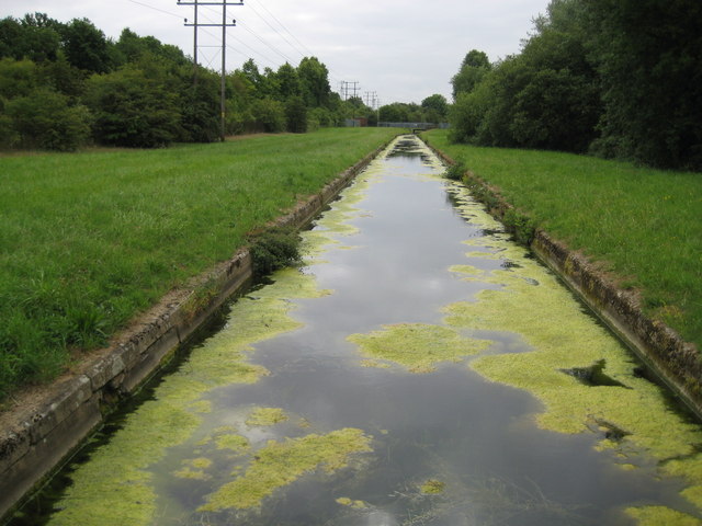
Image: © Nigel Cox Taken: 20 Jun 2010
The aqueduct was completed around 1900 to take water from the River Thames, about 300 metres upstream of Bell Weir Lock in Image, about 3 kilometres downstream to the two new Staines Reservoirs. Sections of the aqueduct are in tunnels with siphons and some reaches such as this are open. Algal bloom is a summer problem in these open sections, although the water is obviously treated between the aqueduct and it becoming the public supply!
Images are licensed for reuse under creativecommons.org/licenses/by-sa/2.0
Image Location
Latitude
51.440826
Longitude
-0.522315