Barton & Broughton station
Introduction
The photograph on this page of Barton & Broughton station by Ian Taylor as part of the Geograph project.
The Geograph project started in 2005 with the aim of publishing, organising and preserving representative images for every square kilometre of Great Britain, Ireland and the Isle of Man.

There are currently over 7.5m images from over 14,400 individuals and you can help contribute to the project by visiting https://www.geograph.org.uk
Barton & Broughton station
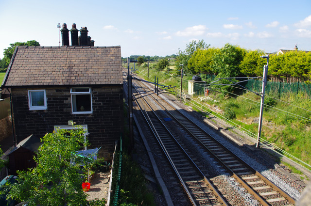
Image: © Ian Taylor Taken: 22 Jun 2010
Looking north towards Lancaster from the road bridge. See Ben Brooksbank's photo Image for a similar view in 1962. The main station buildings on the down platform have been converted to housing, but the up platform and wooden buildings have gone. The electrification of the west coast main line between Weaver Junction (near Crewe) and Glasgow was completed in 1974.
Images are licensed for reuse under creativecommons.org/licenses/by-sa/2.0
Image Location


Leaflet Map data © OpenStreetMap
Latitude
53.820878
Longitude
-2.738358