Mill Lane Industrial Estate, near South Witham
Introduction
The photograph on this page of Mill Lane Industrial Estate, near South Witham by John Sutton as part of the Geograph project.
The Geograph project started in 2005 with the aim of publishing, organising and preserving representative images for every square kilometre of Great Britain, Ireland and the Isle of Man.

There are currently over 7.5m images from over 14,400 individuals and you can help contribute to the project by visiting https://www.geograph.org.uk
Mill Lane Industrial Estate, near South Witham
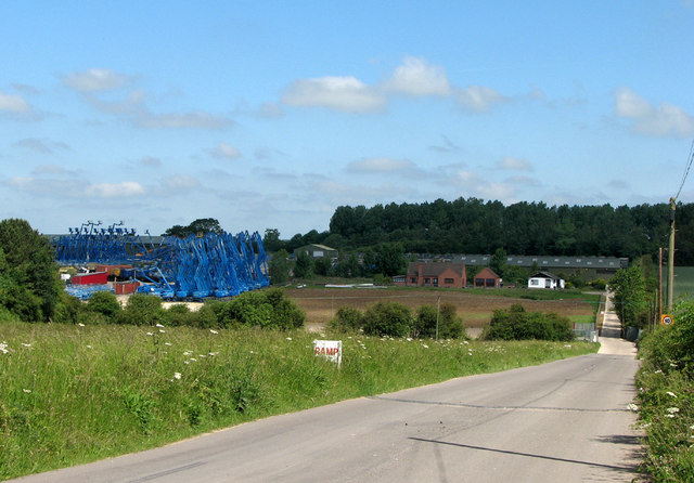
Image: © John Sutton Taken: 17 Jun 2010
A huge cluster of Genie Terex Articulating Boom Lifts is a surprising and rather photogenic sight in the middle of green South Lincolnshire countryside, at Mill Lane Industrial Estate. The industrial estate at South Witham was originally the site of the engine sheds, loading sidings, crusher and offices of Thistleton Mines. Considerable reserves of ironstone – usually extracted by opencast quarrying in the East Midlands – lay below a 60ft bed of Lincolnshire limestone, and it was decided to mine it. The mining complex was built from 1955-7. A 22ft-diameter steel-arch/concrete-segment tunnel was driven 500 yards southwards on a 1 in 40 gradient. The mines were served by a modern double-track narrow-gauge railway operated by one electric and two diesel locomotives, which hauled trains of twelve-ton wagons known as minecars. The mines stretched a mile and a half south and half a mile west, under and beyond the present South Witham limestone quarry. Many of the miners were Scottish coal miners, who lived in houses built for them in South Witham. Production peaked at 390,000 tons a year (and not the million envisaged), but geological difficulties and seepage led to closure on 27 June 1964. The belief that in the second half of the twentieth century it would be necessary to mine ironstone proved misguided: economics prevailed – with the introduction of big dragline excavators, opencast was cheaper. The comparable Easton Mines, near Colsterworth, were equally short-lived, closing in 1967.
Images are licensed for reuse under creativecommons.org/licenses/by-sa/2.0
Image Location
Latitude
52.764897
Longitude
-0.644189