Foxwist Green, Whitegate
Introduction
The photograph on this page of Foxwist Green, Whitegate by michael ely as part of the Geograph project.
The Geograph project started in 2005 with the aim of publishing, organising and preserving representative images for every square kilometre of Great Britain, Ireland and the Isle of Man.

There are currently over 7.5m images from over 14,400 individuals and you can help contribute to the project by visiting https://www.geograph.org.uk
Foxwist Green, Whitegate
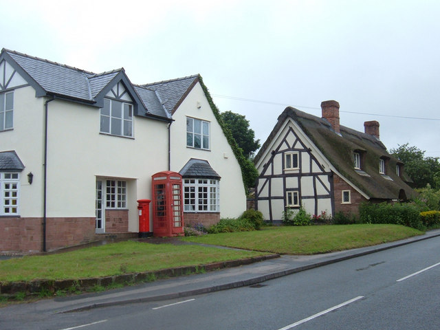
Image: © michael ely Taken: 27 Jun 2006
Looking west along Cinder Hill at the Post Office building (shown as such on the OS's Cheshire Street Atlas). It appears now to be used as a private residence but the telephone box and pillar box remain for the local community.
Images are licensed for reuse under creativecommons.org/licenses/by-sa/2.0
Image Location


Leaflet Map data © OpenStreetMap
Latitude
53.214919
Longitude
-2.564514