Blue plaque, Newport Centre
Introduction
The photograph on this page of Blue plaque, Newport Centre by Jaggery as part of the Geograph project.
The Geograph project started in 2005 with the aim of publishing, organising and preserving representative images for every square kilometre of Great Britain, Ireland and the Isle of Man.

There are currently over 7.5m images from over 14,400 individuals and you can help contribute to the project by visiting https://www.geograph.org.uk
Blue plaque, Newport Centre
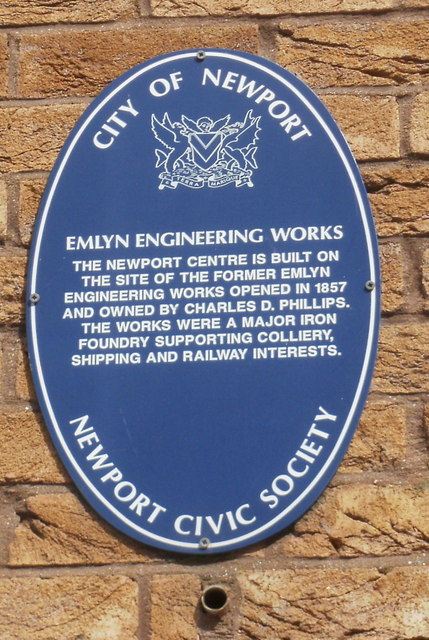
Image: © Jaggery Taken: 20 Jun 2010
Newport Civic Society's blue plaque is on the Kingsway side http://www.geograph.org.uk/photo/5453195 of the Newport Centre. It records that the Centre is built on the site of the former Emlyn Engineering Works, a major iron foundry which opened in 1857.
Images are licensed for reuse under creativecommons.org/licenses/by-sa/2.0
Image Location
Latitude
51.584851
Longitude
-2.992952