Highgate Hill
Introduction
The photograph on this page of Highgate Hill by Derek Harper as part of the Geograph project.
The Geograph project started in 2005 with the aim of publishing, organising and preserving representative images for every square kilometre of Great Britain, Ireland and the Isle of Man.

There are currently over 7.5m images from over 14,400 individuals and you can help contribute to the project by visiting https://www.geograph.org.uk
Highgate Hill
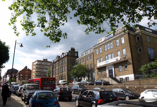
Image: © Derek Harper Taken: 12 Jun 2010
Traffic is worse than usual in Highgate because of the Fair in the Square, which has closed some roads. On the right is Channing School.
Images are licensed for reuse under creativecommons.org/licenses/by-sa/2.0
Image Location
Latitude
51.569979
Longitude
-0.14426