Tornado
Introduction
The photograph on this page of Tornado by Tony Atkin as part of the Geograph project.
The Geograph project started in 2005 with the aim of publishing, organising and preserving representative images for every square kilometre of Great Britain, Ireland and the Isle of Man.

There are currently over 7.5m images from over 14,400 individuals and you can help contribute to the project by visiting https://www.geograph.org.uk
Tornado
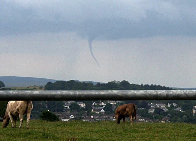
Image: © Tony Atkin Taken: 25 Jun 2006
This twister was seen from the western edge of Tavistock. The funnel cloud itself was somewhere over the western edge of Dartmoor between Princetown and Yelverton. The mast on the left side of the picture is on North Hessary Tor. The weather conditions at the time were hot and humid with cloud and showers building up over the land and a light breeze. There were no reports of damage. As photographed here it is not actually a tornado, just a funnel cloud, as it is not touching the ground although a photograph of this storm printed in a local newspaper the following day did appear to show this happening.
Images are licensed for reuse under creativecommons.org/licenses/by-sa/2.0
Image Location


Leaflet Map data © OpenStreetMap
Latitude
50.540251
Longitude
-4.16338