Railway bridge, Craigavad
Introduction
The photograph on this page of Railway bridge, Craigavad by Rossographer as part of the Geograph project.
The Geograph project started in 2005 with the aim of publishing, organising and preserving representative images for every square kilometre of Great Britain, Ireland and the Isle of Man.

There are currently over 7.5m images from over 14,400 individuals and you can help contribute to the project by visiting https://www.geograph.org.uk
Railway bridge, Craigavad
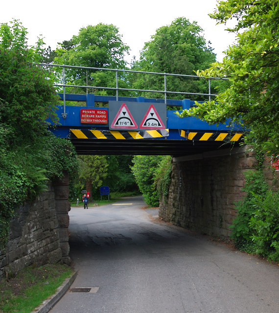
Image: © Rossographer Taken: 16 Jun 2010
Railway bridge above Station Road at Craigavad. The bridge carries Bangor-Belfast line. A point to note: the bridge carries a sign stating that this is a "Private Road". This is nonsense; the road is a public right of way and, although technically a very long cul-de-sac, offers access to the shoreline and North Down Coastal Path. It is, however, a rather exclusive area and the wealthy residents would probably like to deter as many people away as possible (interestingly, they managed to scare Google - 'Street View' for this road ends at the bridge). There is also a bench mark on the bridge - see Image
Images are licensed for reuse under creativecommons.org/licenses/by-sa/2.0
Image Location
Latitude
54.655533
Longitude
-5.792135