The Stuckie Bridge
Introduction
The photograph on this page of The Stuckie Bridge by Lairich Rig as part of the Geograph project.
The Geograph project started in 2005 with the aim of publishing, organising and preserving representative images for every square kilometre of Great Britain, Ireland and the Isle of Man.

There are currently over 7.5m images from over 14,400 individuals and you can help contribute to the project by visiting https://www.geograph.org.uk
The Stuckie Bridge
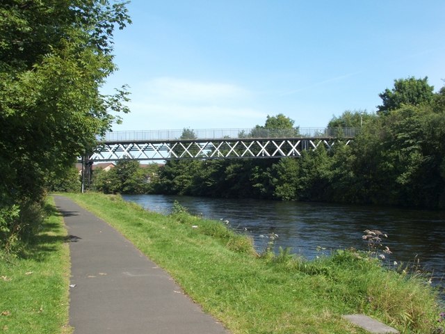
Image: © Lairich Rig Taken: 22 Aug 2007
This bridge crosses the River Leven, leading from Rosshead to Jamestown. Rosshead is at its western end (on the left in this picture), and Jamestown at its eastern end. The bridge was originally a viaduct for the Forth and Clyde Junction Railway; it replaced an earlier wooden structure. See Image for a view showing details of the underside. It is informally known as the Stuckie Bridge; some years ago, that name was explained to me as being the result of an obscure play on words, as follows: it is properly the "Stirling Bridge"; "Stirling" was first altered to "Starling", and then to "Stuckie" (the old Scots name for that bird). This explanation is confirmed by the Vale of Leven website, which provides further information, in an article by Gordon Burns, about the various bridges that cross the Leven: http://www.valeofleven.org.uk/levenbridges.html For similar views, see Image and Image See Image for a view of the path that now leads over the bridge.
Images are licensed for reuse under creativecommons.org/licenses/by-sa/2.0
Image Location
Latitude
55.997106
Longitude
-4.574115