Newport : south side of Hill Street
Introduction
The photograph on this page of Newport : south side of Hill Street by Jaggery as part of the Geograph project.
The Geograph project started in 2005 with the aim of publishing, organising and preserving representative images for every square kilometre of Great Britain, Ireland and the Isle of Man.

There are currently over 7.5m images from over 14,400 individuals and you can help contribute to the project by visiting https://www.geograph.org.uk
Newport : south side of Hill Street
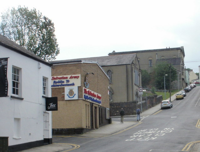
Image: © Jaggery Taken: 13 Jun 2010
Viewed from the corner of Commercial Street. In contrast to the north side of the street, which has mainly terraced houses, http://www.geograph.org.uk/photo/1181451 this side of the street is dominated by four large buildings. Jazz Hair Company at 2 Hill Street is on the corner of Commercial Street. The Salvation Army Citadel http://www.geograph.org.uk/photo/1585015 extends into Ivor Street. On the other corner of Ivor Street and Hill Street is the Welsh Church. http://www.geograph.org.uk/photo/1912304 At the top of the hill, on the corner of Victoria Road, is the United Reformed Church. http://www.geograph.org.uk/photo/1181447
Images are licensed for reuse under creativecommons.org/licenses/by-sa/2.0
Image Location
Latitude
51.583915
Longitude
-2.997261