Railway tunnel, Castlerock
Introduction
The photograph on this page of Railway tunnel, Castlerock by Albert Bridge as part of the Geograph project.
The Geograph project started in 2005 with the aim of publishing, organising and preserving representative images for every square kilometre of Great Britain, Ireland and the Isle of Man.

There are currently over 7.5m images from over 14,400 individuals and you can help contribute to the project by visiting https://www.geograph.org.uk
Railway tunnel, Castlerock
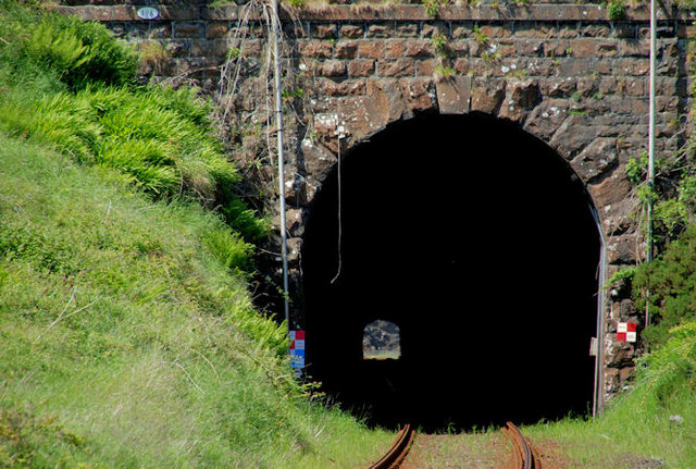
Image: © Albert Bridge Taken: 12 Jun 2010
About ¼ mile after Castlerock station Image the railway enters Castlerock tunnel (668 yards). Beyond, after a short spell in the open, it enters the shorter Downhill tunnel (307 yards). The red and white chequered signs indicate restricted clearance (for railway employees). I’m told that there are recesses (once known as “manholes”) inside to allow permanent way staff to shelter in the event of being in the tunnel when a train is passing.
Images are licensed for reuse under creativecommons.org/licenses/by-sa/2.0
Image Location
Latitude
55.166989
Longitude
-6.795802