Houses in The Slade
Introduction
The photograph on this page of Houses in The Slade by Natasha Ceridwen de Chroustchoff as part of the Geograph project.
The Geograph project started in 2005 with the aim of publishing, organising and preserving representative images for every square kilometre of Great Britain, Ireland and the Isle of Man.

There are currently over 7.5m images from over 14,400 individuals and you can help contribute to the project by visiting https://www.geograph.org.uk
Houses in The Slade
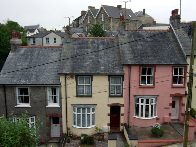
Image: © Natasha Ceridwen de Chroustchoff Taken: 9 Jun 2010
Tightly packed houses on one side of The Slade, a steep street going down to the old harbour. The name, which is not Welsh, is usually said to derive from an Old English word for valley or slope, alternatively it has been suggested that it was related to slide since boats were once built and launched at the bottom of the hill. Beyond, houses can be seen on higher ground in West Street.
Images are licensed for reuse under creativecommons.org/licenses/by-sa/2.0
Image Location
Latitude
51.995011
Longitude
-4.977839