War Memorial, Bredbury and Romiley
Introduction
The photograph on this page of War Memorial, Bredbury and Romiley by David Dixon as part of the Geograph project.
The Geograph project started in 2005 with the aim of publishing, organising and preserving representative images for every square kilometre of Great Britain, Ireland and the Isle of Man.

There are currently over 7.5m images from over 14,400 individuals and you can help contribute to the project by visiting https://www.geograph.org.uk
War Memorial, Bredbury and Romiley
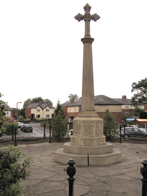
Image: © David Dixon Taken: 10 Jun 2010
The Bredbury and Romiley War Memorial is in a small grassed circle at the top of Barrack Hill, at the junction of Kings Road, George Lane and Berrycroft Lane. In this view, Kings Road and Ruskin Grove are behind the memorial. See Image]
Images are licensed for reuse under creativecommons.org/licenses/by-sa/2.0
Image Location
Latitude
53.415986
Longitude
-2.102044