River Lea Waterfall at Batford
Introduction
The photograph on this page of River Lea Waterfall at Batford by Stan Ames as part of the Geograph project.
The Geograph project started in 2005 with the aim of publishing, organising and preserving representative images for every square kilometre of Great Britain, Ireland and the Isle of Man.

There are currently over 7.5m images from over 14,400 individuals and you can help contribute to the project by visiting https://www.geograph.org.uk
River Lea Waterfall at Batford
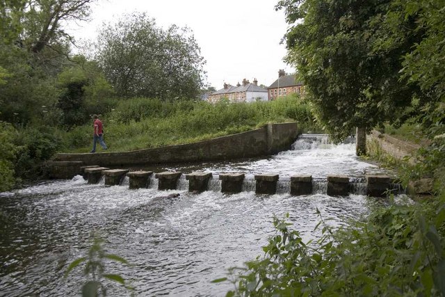
Image: © Stan Ames Taken: 23 Jun 2006
This waterfall was constructed by local volunteers in the 1970s and forms part of Batford Springs Local Nature Reserve. The area contains several small springs and was used as watercress beds in the 19th century. The waterfall is adjacent to Batford Mill on the B653.
Images are licensed for reuse under creativecommons.org/licenses/by-sa/2.0
Image Location
Latitude
51.820962
Longitude
-0.337248