Coombe Street, Bruton in 1985
Introduction
The photograph on this page of Coombe Street, Bruton in 1985 by John Baker as part of the Geograph project.
The Geograph project started in 2005 with the aim of publishing, organising and preserving representative images for every square kilometre of Great Britain, Ireland and the Isle of Man.

There are currently over 7.5m images from over 14,400 individuals and you can help contribute to the project by visiting https://www.geograph.org.uk
Coombe Street, Bruton in 1985
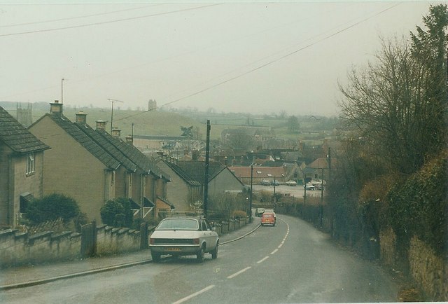
Image: © John Baker Taken: 29 Mar 1985
The tower of St Mary's church can be seen on the far left of the view while on the far hillside is Bruton's famous dovecot
Images are licensed for reuse under creativecommons.org/licenses/by-sa/2.0
Image Location
Latitude
51.113951
Longitude
-2.453382