Naul's Mill Park
Introduction
The photograph on this page of Naul's Mill Park by E Gammie as part of the Geograph project.
The Geograph project started in 2005 with the aim of publishing, organising and preserving representative images for every square kilometre of Great Britain, Ireland and the Isle of Man.

There are currently over 7.5m images from over 14,400 individuals and you can help contribute to the project by visiting https://www.geograph.org.uk
Naul's Mill Park
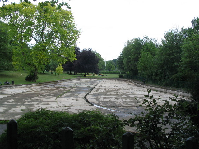
Image: © E Gammie Taken: 9 Jun 2010
Would you believe it? It's been tipping it down with rain the past couple of days and the boating pond is empty! The area of concrete is represented on the map by a blue blob normally indicating a body of water. The park was created in the early 20th century on the site of a water mill, demolished in 1889, and its feeder pond. Postcards from around 1909, when it was opened, show it with plantings of very young trees, which have matured to give it a very different appearance. The bandstand which stood at the end of the pond was removed in the 1960s.
Images are licensed for reuse under creativecommons.org/licenses/by-sa/2.0
Image Location


Leaflet Map data © OpenStreetMap
Latitude
52.413327
Longitude
-1.518027