2010 : West from Rookery Lane
Introduction
The photograph on this page of 2010 : West from Rookery Lane by Maurice Pullin as part of the Geograph project.
The Geograph project started in 2005 with the aim of publishing, organising and preserving representative images for every square kilometre of Great Britain, Ireland and the Isle of Man.

There are currently over 7.5m images from over 14,400 individuals and you can help contribute to the project by visiting https://www.geograph.org.uk
2010 : West from Rookery Lane
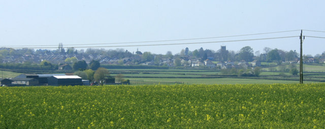
Image: © Maurice Pullin Taken: 23 Apr 2010
A pasture with dandelions then Churchmead Farm to the left. Then a view of Pucklechurch with its parish church to the right. The valley between is occupied by the Feltham Brook.
Images are licensed for reuse under creativecommons.org/licenses/by-sa/2.0
Image Location
Latitude
51.483395
Longitude
-2.412971