The Plough, Dymchurch Road
Introduction
The photograph on this page of The Plough, Dymchurch Road by P L Chadwick as part of the Geograph project.
The Geograph project started in 2005 with the aim of publishing, organising and preserving representative images for every square kilometre of Great Britain, Ireland and the Isle of Man.

There are currently over 7.5m images from over 14,400 individuals and you can help contribute to the project by visiting https://www.geograph.org.uk
The Plough, Dymchurch Road
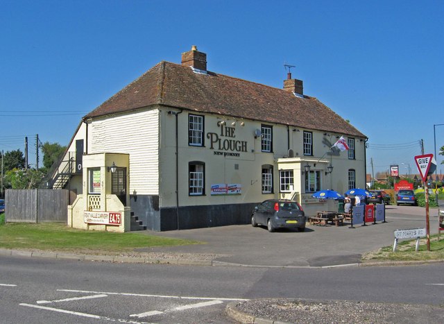
Image: © P L Chadwick Taken: 24 May 2010
Located on the corner of St. Mary's Road and Dymchurch Road (the A259). It has an interesting history. It was built in 1776 and may have been a toll house in the days of turnpike roads. Certainly it became an important stopping point for fast mailcoaches, and there were extensive stables here to facilitate the changing of horses. When that era was over, the stables were used for storage and the business carried on as a wayside inn. For a long time it was a Whitbread house, but since then the signage and the pub's sign have completely changed. Image
Images are licensed for reuse under creativecommons.org/licenses/by-sa/2.0
Image Location
Latitude
50.990861
Longitude
0.94794